New Resume
| Name | Preferred Locations | Updated |
|---|---|---|
| Ramla Khan |
United Kingdom (UK)
| 14/01/2025 |
| Sriram Krishnasamy Seenivasan |
Milan, Italy
| 14/01/2025 |
| sandeep shukla |
india, India
| 13/01/2025 |
| Dr Dheerendra Pratap Singh |
Greater Noida, India
| 06/01/2025 |
| Sunita choudhary |
Lucknow, India
| 04/01/2025 |
| Prashant Kumar Chourasia |
India
| 02/01/2025 |
| NITYANAND |
Chandauli, India
| 02/01/2025 |
| aniket kokani |
thane, India
| 01/01/2025 |
| SANJAY KUMAR MAHAWAR |
New Delhi, India
| 30/12/2024 |
| ATANU HAZARIKA |
Guwahati, Assam, India
| 27/12/2024 |
Data Download Links
PhD/Post-Doctoral Positions
RS & GIS Contents
Standard Operating Procedures of Drone Survey in Mine Area, GoI
Standard Operating Procedures of Drone Survey in Mine Area, GoI. Standard Operating Procedures under sub rule (5) of rule 34A of MCDR, 2017 for carrying

ESRI Shapefile | Free Shapefile Download|Arcgis File Download
ESRI Shapefile is a file format that is widely used in the field of geographic information systems (GIS) to store and manage spatial data. It

Global Positioning System|GPS
Global Positioning System, also known as GPS, is a satellite-based navigation system that is used to determine the location and time information of an object
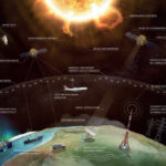
Apply for ESA Academy’s brand new Space Weather Training Course
In brief ESA Academy is proud to announce that university students may now apply for the pilot edition of the Space Weather Training Course, to
The European Space Agency (ESA): 7th ADVANCED TRAINING COURSE ON RADAR POLARIMETRY
The European Space Agency (ESA) is organizing the 7th ESA Advanced Course on Radar Polarimetry for training the next generation of Earth Observation (EO) scientists in

Tending method for identifying and mapping flood extent and flood-affected paddy rice fields | GEE Code available
Flood: a natural disaster Flooding is a recurring natural disaster in the Indian subcontinent, affecting millions of people’s lives, infrastructures, economics, and local ecosystems. The

Geospatial Intelligence and Machine Learning Applications in the Air Force: An In-Depth Analysis
Geospatial intelligence (GEOINT) is the collection, analysis, and interpretation of data from Earth-based and space-based sources to provide insights into the physical features and activities
Honorary Doctorate – ‘Dr’
An honorary doctorate is an esteemed academic recognition that is awarded to outstanding individuals who have made significant contributions to society or a specific field.

Remote Sensing of Environment
Remote Sensing of Environment Journal Remote Sensing of Environment (RSE) serves the Earth observation community with the publication of results on the theory, science, applications, and
Geospatial Bill of India 2022
What is the Geospatial Bill of India 1.2. The National Geospatial Policy, 2022 (the Policy) is a citizen-centric policy that seeks to strengthen the Geospatial
IIRS, ISRO: Engagement of Technician (Diploma Holders) & Graduate (Engg. / Tech.) Apprentices
Organization: Indian Institute of Remote Sensing (IIRS) Location: Dehradun, India Close Date to Apply: 09 October 2021 at 1730 hrs Indian Institute of Remote Sensing

Govt. of India Launches New Geospatial Planning Portal, ‘Yuktdhara’ to facilitate Planning of New MGNREGA assets
Mahatma Gandhi Employment Guarantee Act 2005 (or, NREGA No 42, later renamed as the “Mahatma Gandhi National Rural Employment Guarantee Act” or MGNREGA), is an Indian


